Barbury Castle and Ogbourne St Andrew
May 16, 2025
Wroughton, England, United Kingdom
Easy
Not completed
Description
Route
Start
Start
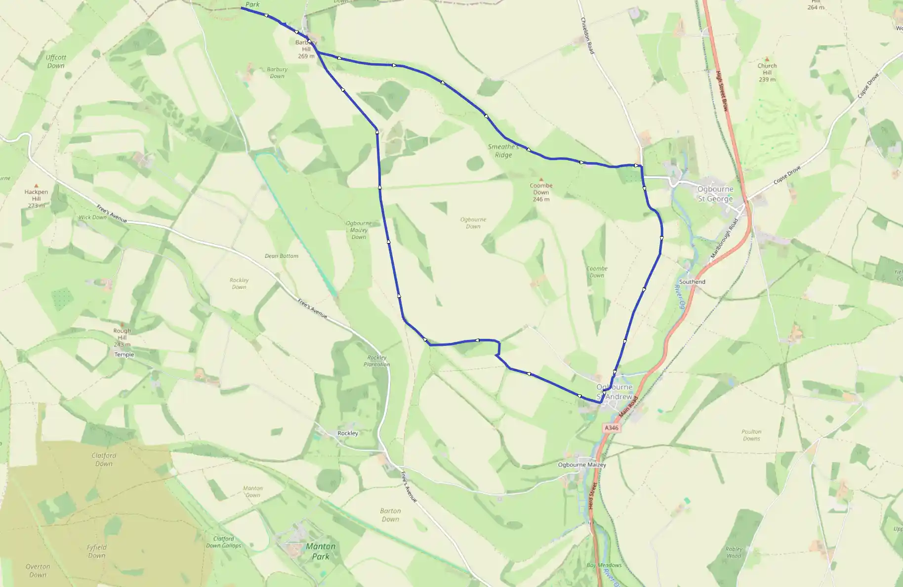
51.48379, -1.77745The walk begins on the Ridgeway - possibly the oldest routeway in Britain - which runs along the south side of the car park. Although the main part of the route lies to the left, first turn right, passing an information centre and going through a gate, to visit the earthworks of Barbury Castle, a large Iron Age fort defended by a double bank and ditches. The ditches enclose an area of 12'2 acres (5 ha), and the site may have been re-fortified in Saxon times, as excavations have revealed evidence of a long period of occupation. As well as being impressive in its own right, the fort is also a magnificent viewpoint. Retrace your steps to the car park and continue along the Ridgeway to a gateway. Go through and turn right along a track.
906 m
At a Ridgeway post turn left to follow a track across the downs, keeping along the top of Smeathe's Ridge. The views from here are superb. Go through a metal gate and after keeping by a wire fence on the right, look out for where the track bears left and downhill away from it. Go through a gateway at a fork and continue along the left-hand lower track, go through two more metal gates and eventually walk along an enclosed track which descends gently to a lane.
3.19 km
Turn right and where the lane bends left, keep ahead along an enclosed, tree-lined track. At a signpost where the enclosed section ends, continue ahead and eventually the tower of Ogbourne St Andrew Church comes into view, nestling at the foot of the down. Eventually the track emerges on to a lane. Turn right along it through the village, passing to the left of the medieval church, to a T-junction.
4.85 km
The Silks on the Downs, a gastro pub is off to the left but the route continues to the right along a tarmac drive which soon divides. Stay on the main track and keep ahead, climbing gently back on to the downs. After descending, the track peters out - at this point bear right through a metal gate, head downhill across a field and in the bottom corner go through another metal gate on to a track.
5.69 km
Turn left and the track bends right and heads uphill towards a large barn on the skyline. Pass to the right of this barn and turn right along a track. On joining a broader track at a Byway sign, bear right along it and follow it gently uphill across the broad downs.
6.38 km
The track continues along the left inside edge of a group of trees, Four Mile Clump, and leads back to the start.
13.76 km
Finish