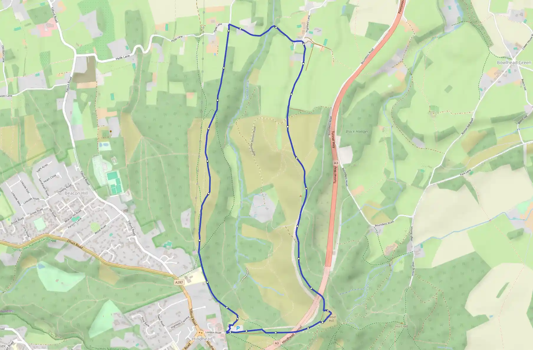
Description
Route
Start
2 m
Facing the front entrance of the National Trust café, bear right across the car park to pick up a rough track leading to a wonderful viewpoint. Bear left from here on the main track. Later this runs with a fence on the left and leads on to a well-placed seat with views over the natural amphitheatre.
542 m
At a path junction bear right, and pass a green metal barrier and a cattle-grid through a hand-gate and head for Highcomb Copse on a broad track along the western edge of the Punchbowl. Here there is open woodland with a frequent thick carpet of bracken. Occasional views show the ground falling away dramatically to your right.
829 m
At a waymarked post where the track forks three ways, take the right-hand fork, on a path which is a detour to an excellent viewpoint from where you can see Highcomb Bottom and the Hog's Back. A memorial to the brothers of W.A. Robertson stands here. One was killed in the First World War, and Highcomb Copse was given to the National Trust by their family to commemorate the men's sacrifice. Continue past the monument to return to the main path, which descends gently. At another waymarked post at a crossing of paths keep straight ahead along the main track. The path begins to descend more steeply through Vanhurst Copse and in doing so becomes narrow and enclosed. Go through a gate and a National Trust boundary marker shows where you leave Trust land. The steep path can be heavy going after wet weather, but eventually it reaches Hyde Lane.
1.91 km
Turn right here to pass Ridgeway Farm. Now there is another steep section down a path with high banks to a footbridge over a small stream.
2.22 km
Do not go over the stile ahead but bear right up a track, forking left to reach a lane. Turn left again and then right after 100 yards, waymarked Greensand Way.
2.41 km
A long climb up a shady track with a good surface brings you to a National Trust signboard where the track divides. Bear right here, continuing to follow the Greensand Way, and then left a little farther on. Go straight over the footpath junction, which follows almost immediately, signed 'Gibbet Hill 1¼m'. The climb continues, but at last the scenery changes to heathland and the sandy path reaches the top of the ridge, where there are views, which overlook the Punchbowl. Follow the path down, pass beside a cattle-grid and reach the line of the former A3, now landscaped into the heathland.
3.49 km
Take the path opposite signposted 'Unsuitable for motor vehicles' following a Greensand Way sign and continue uphill. Near the top of the climb, pass a green metal barrier and, on the right, a milestone. Just past the milestone, look out for a National Trust 'Gibbet Hill' sign off to the left and turn left along the access track to reach the triangulation pillar of Gibbet Hill
4.16 km
Back in 1786 an unknown sailor was murdered nearby and the culprits were executed and their bodies left to the mercy of the elements on the hilltop gibbet, a kind of cage with chains. A granite Celtic cross was erected nearby to ward off any evil spirits. Retrace your steps and continue gently downhill and you will soon pass the sailor's memorial stone on the right. Keep ahead and follow the lane back to the National Trust car park.
7.82 km
Finish