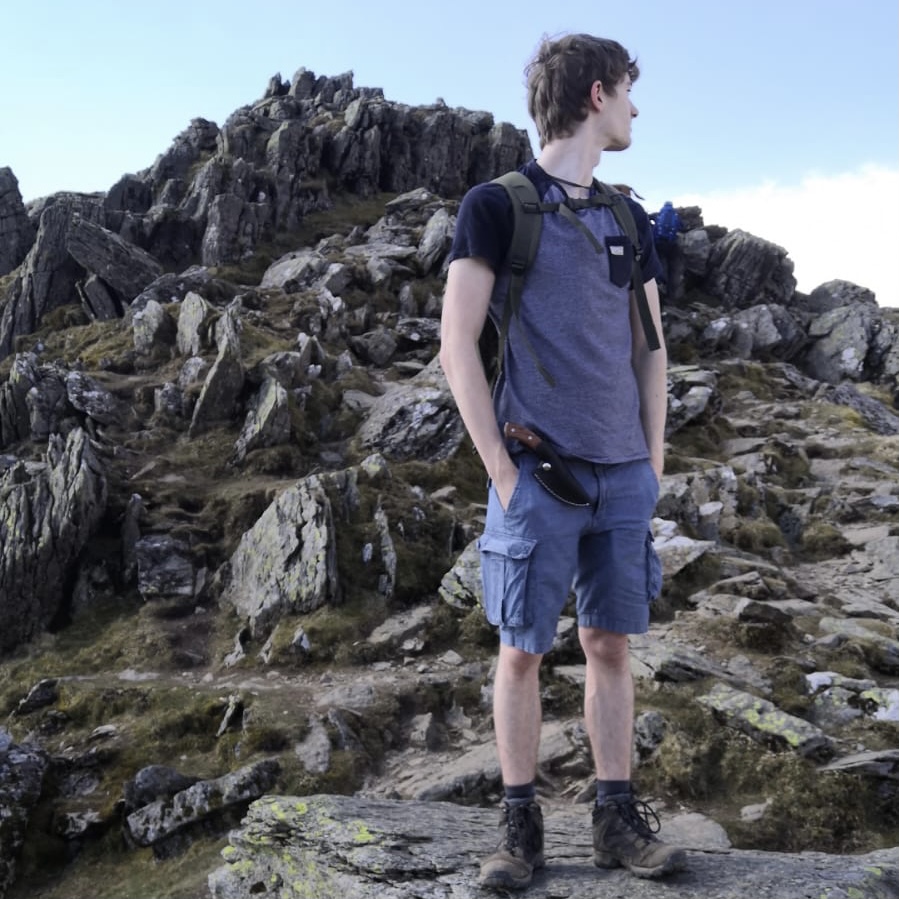
The Temple of the Winds was a summerhouse built at the summit of Blackdown by Alfred, Lord Tennyson when he lived at nearby Aldworth House. The summerhouse has gone but the viewpoint remains. At 919 feet (280m) it is the highest point in the county.
The Temple of the Winds from Fernhurst
May 18, 2025
Chichester, England, United Kingdom
Easy
Distance 10.52 km
Est. duration 02h 21m
Elevation Gain 283 m
Elevation Loss 281 m
Category Hiking
Description
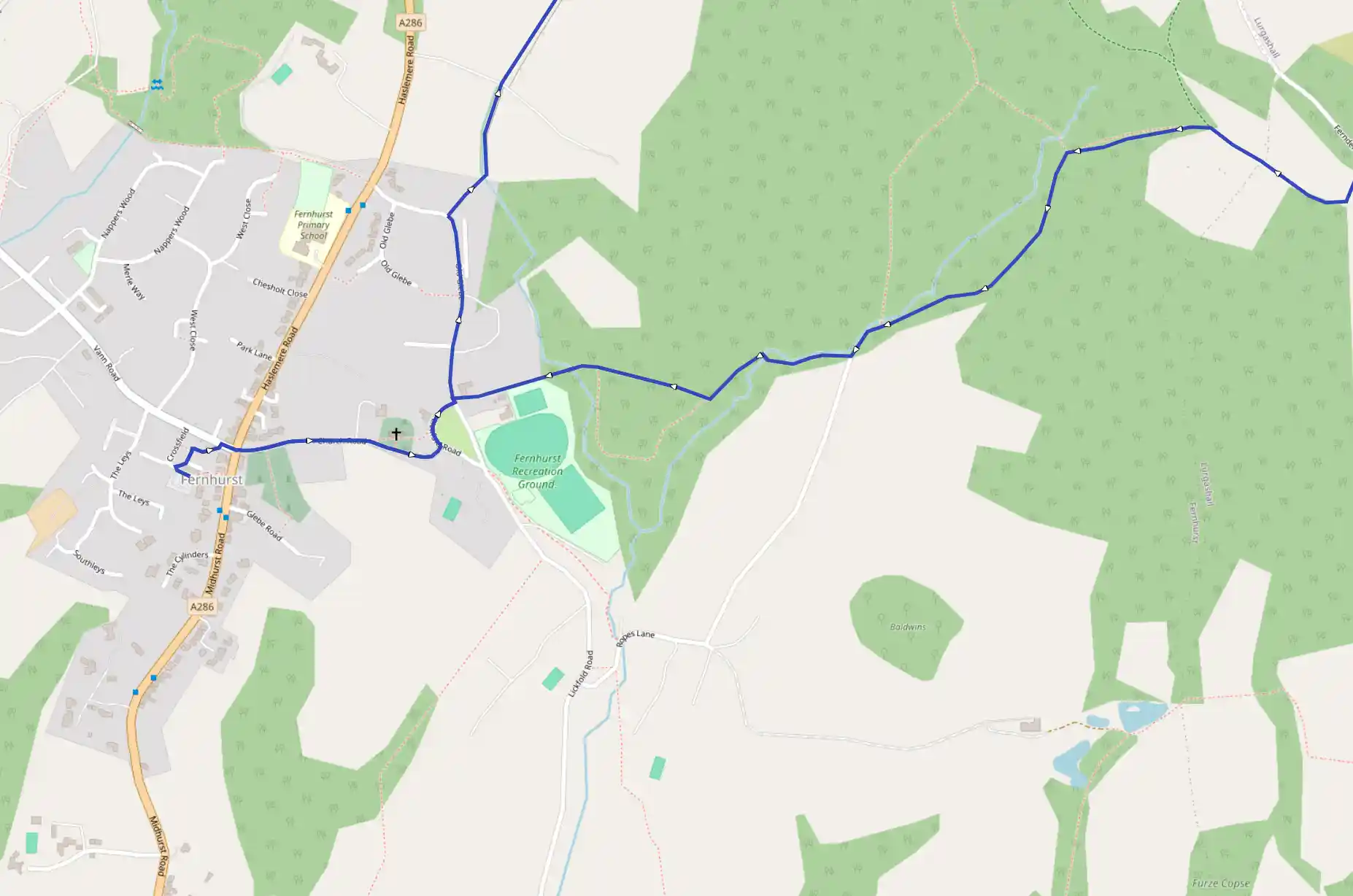
Route
Start
Start
51.04827, -0.72386Cross the main road at Fernhurst (A286) into Church Road and pass the church, which was virtually rebuilt by Anthony Salvin, a local resident, in the 19th century. Continue to the green and turn left towards the Red Lion. At the junction in front of it, turn left and head up the slope. Follow the road and as it bends left towards the main road, take the path on the right. Follow it between gardens and soon cross a stile to skirt a field before reaching the next stile. Cross a tarmac drive and continue ahead in the next field. Make for a stile at the top and keep ahead in the next pasture. When you reach another tarmac drive, keep right, at the sign for 'Copyhold'. Beyond a house take the path on the right, over a stile.
1.11 km
51.05894, -0.71390
The path descends to the bottom of the valley, and there are ponds to the right. The climb, to the other side of the valley, is steep. Bear right at the top to climb a low bank and join a bridleway. Turn left onto the grassy track, pausing to look back at the fine view. Farther on, avoid a bridleway sign and a path running down to a tarmac drive and continue on the path parallel to it. On reaching the drive, turn right and walk along to the road by a sign for Sheetlands. Turn left here and, immediately after the gate to Wadesmarsh Farmhouse, leave the road to the right to enter the National Trust's Valewood Park.
1.94 km
51.06679, -0.70821
The parkland provides lovely walking with the house and lake to the right and specimen trees ahead. The path joins the drive from the house. After 120 yards leave the drive to the right for a footpath that climbs steps to a kissing-gate.
2.50 km
51.07414, -0.70784
At the field-top corner and fingerpost turn right to go through a gate and walk below the trees to a gate, in line with sheds below to the right. Through it, rise into the woods. The path goes up through trees to a kissing-gate and footpath sign. Head straight on across the field, keeping trees on the right. Go through a gate and follow a bridleway track, waymarked Serpent Trail. Through the next gate, follow Serpent Trail and Sussex Border Path waymarks half-right, and enjoy this relaxing woodland track. At length, bear right at a junction and Serpent Trail sign, and keep forward to a gate and bridleway crossing.
3.30 km
51.06682, -0.69861
This is Black Down. After about ½ mile (800m) the sandy pathway descends to a junction.
3.74 km
51.06379, -0.69042
Keep left, avoiding a path on the extreme left, pass a sunken path on the right and when you reach several pools, turn right onto a bridleway. Keep right immediately onto another bridleway.
3.88 km
51.06512, -0.68834
Take the next left fork and continue through the trees. Pass a path merging from the right and then steps leading off to the left before eventually taking a path signposted Temple of the Winds. This leads to the rim of a steep slope and dips to the memorial seat to Mabel, wife of Edward Hunter, who gave Black Down to the National Trust in 1944. This was the site of the summerhouse erected by Tennyson during the 24 years that he occupied Aldworth House, the home he built a mile or so to the north. Remarkably this was open country until 1958 when the National Trust began to plant conifers. Walk clockwise round the summit to pass a strategically placed rustic seat, pausing to enjoy the beautiful view. Then bear left on to a path that descends the spur to the south-weest, and pass through a gate to walk between high banks. Turn right when it reaches a lane, but after a few yards go left down a bridleway track which soon swings right.
5.03 km
51.05293, -0.69598
After a house, keep left at a junction on a path that leads down into woodland and that has at least a trickle of water flowing down most of the year. Cross a track and continue down the mossy-banked path, which merges with a waymarked track farther down. Keep ahead and at the point where it reaches a lane, at Tanyard Cottage, turn right on to a path into woodland, with the stream to the right.
5.72 km
51.05006, -0.70821
Bend right to walk with a field, and then Fernhurst's cricket groun, to the left. The path emerges into the village next to the Red Lion inn. Retract your steps to the A286.
10.52 km
Finish